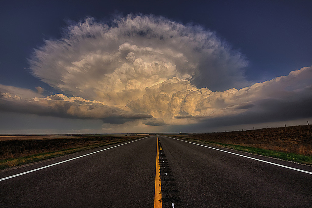
Storm Chase Location: Ashland Kansas Storm Chase Date: May 8th 2013 Storm Chaser: Zach Roberts Camera Settings: Camera Pentax K-x Exposure 0.008 sec (1/125) Aperture f/11.0 Focal Length 10 mm ISO Speed 200 Low precipitation supercells are some of the most photographic storms on the planet. The= […]
Read more →Archive for November 2013
Storm Chase Date: May 18th, 2013 Storm Chase Location: Buffalo, Oklahoma Storm Chaser: Zach Roberts Camera Settings: Camera Pentax K-x Exposure 0.167 sec (1/6) Aperture f/13.0 Focal Length 10 mm ISO Speed 200 A sunset near Buffalo Oklahoma over an old abandoned building. Storm chasing is surprisingly […]
Read more →Storm Chase Date: May 2012 Storm Chase Location: Western Kansas Storm Chaser: Zach Roberts Camera Settings: Pentax Kx One of my top 5 non tornado chases. May of 2012 in Western Kansas. Three updrafts rocketing skyward just as the sun hit its peak colors. Was an amazing […]
Read more →Storm Chase Date: June 28th, 2012 Storm Chase Location: Saskatchewan, Canada Storm Chaser: Zach Roberts Camera Settings: Pentax Kx A rapidly rotating wall cloud spins above the Saskatchewan Canada plains. This tornado had already produced two violent tornadoes earlier. June 2012
Read more →Are November tornadoes rare? Was the November 17th Outbreak abnormal? Understandably, I have seen these questions asked via social media hundreds of times over the last several days. With the recent outbreak of tornadoes on the 17th in Illinois and Indiana that claimed 8 lives many people […]
Read more →Storm Chase Date: October 4th, 2013 Storm Chase Location: NW of Waterbury Nebraska Storm Chaser: Zach Roberts Camera Settings: Camera Pentax K-x Exposure 0.025 sec (1/40) Aperture f/13.0 Focal Length 10 mm ISO Speed 200 A massive stove pipe tornado churns near Waterbury Nebraska as the setting […]
Read more →A very dangerous weather situation will ramp up over the next several hours as potent storm system enters the Great Lakes and Ohio Valley. Thunderstorms will begin to form this morning over parts of Iowa and Missouri. These storms will strengthen rapidly into supercells capable of large […]
Read more →A rare high risk has been issued by the SPC for Sunday 11/17. Long track strong tornadoes likely across portions of Illinois and Indiana. Tornadoes, damaging winds and large hail likely across portions of Kentucky, Illinois, Ohio, Michigan, Kentucky, Wisconsin and Tennessee. More updates to follow. Wording […]
Read more →A widespread severe weather event will likely take place tomorrow from the Great Lakes through the Ohio and Tennessee Valley. A damaging wind event will likely take place as a line of storms develop along a cold front from Michigan to Tennessee and sweeps East into Sunday night. […]
Read more →