A severe weather threat looks to be taking shape this weekend for parts of the Mississippi and Ohio Valley. A potent trough will reside over the area outlined below on Sunday 11/17 if current models are correct. With ample moisture making a return, strong wind shear and just enough CAPE a severe weather threat including tornadoes will be possible. We still have a good deal of time to iron this out but it looks as though Arkansas, Tennessee, Kentucky, Missouri, Illinois and Ohio could all be in for a round of storms. The area most at risk is yet to be determined and I will update more as we get closer. Tornado events are not out of the question this time of year and those that live in the area outline below need to take notice.
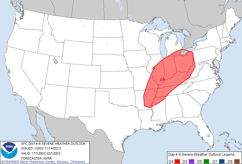
Day 4 severe weather risk area as outlined by the Storm Prediction Center.

12z GFS 500mb run showing a trough digging in over the US at 6pm CST Sunday 11/17. Strong 100kt winds indicated.
Zach Roberts
Owner-Mr Twister