
A widespread severe weather event will likely take place tomorrow from the Great Lakes through the Ohio and Tennessee Valley. A damaging wind event will likely take place as a line of storms develop along a cold front from Michigan to Tennessee and sweeps East into Sunday night. A modest tornado threat may also develop with any storms that form ahead of the cold front but the extent of this threat is still somewhat uncertain. The threat for tornadoes would develop earlier in the AM in Eastern Illinois and move East into the early afternoon. Regardless, the area outlined in red has the largest threat for damaging winds, tornadoes and large hail. Stay tuned for more updates.
Major Cities In Highest Risk Area:
Chicago IL
Evansville IN
Louisville KY
Cincinnati OH
Indianapolis IN
Fort Wayne IN
Columbus OH
Detroit MI
Cleveland OH
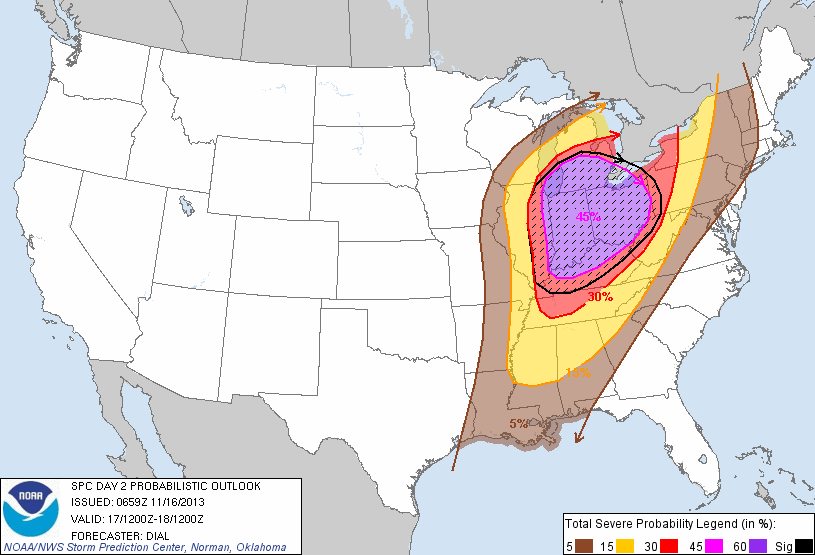
Severe Weather Threat area 11/17
Zach Roberts
Owner Mr Twister

Related articles
- Significant Severe Weather Outbreak Alert 11/17/2013 (lunaticoutpost.com)


Pingback: Rare High Risk Issued for Sunday 11/17 | Mr Twister