
A severe weather threat will evolve Saturday and into Sunday for a good portion of the Mississippi, Tennessee and Ohio Valley. A cold front will with associated low pressure system will move across the areas outline below. Strong shear and moisture return will be in place leading to the potential for a line of storms to develop (some with supercell characteristics) late Saturday evening and on into the day on Sunday. The main threat at this point looks to be damaging winds but if enough destabilizing can occur a tornado threat cant be ruled out. The highest threat looks to be early Sunday afternoon. If you live in the areas outline below stay tuned to the developing threat. I will update more into Saturday.
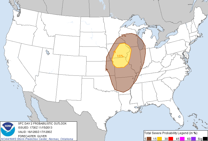
Severe weather threat for Saturday 11/16

Severe Weather Threat area for Sunday 11/17
Zach Roberts
Owner-Mr Twister

Related articles
- Will Severe Storms Threaten Your Weekend in Atlanta? (stormwatchatlanta.wordpress.com)
- Storms forecast for weekend in Arkansas (arkansasonline.com)

