The top 10 weather photographs shared in the Mr Twister
Weather Snapshot group on October 4th 2014

DONATE TO TORNADO VICTIMS
#1 Jack Miller (430 Likes)
Follow Jack Finally Florida delivered last night. Captured this little sucker off the coast of New Smyrna Beach as the storm systems entered into the Gulf Stream and exploded. ƒ/9 ISO 640 20 Seconds 40mm Canon 6D w/17-40L
#2 Justin Battles (409 Likes)
Follow Justin One of the most photogenic storms at sunset I’ve had the pleasure of witnessing, last month at Myakka State Park near Sarasota, Florida on a most sobering day 9-11-14.
#3 Eric Treece (356 Likes)
Follow Eric This was a little later than the shot I posted yesterday as the shelf cloud made its approach to us on Northern Lake Michigan in July 19, 2013.
#4 Steven Coy (197 Likes)
Follow Steven One of the most incredible lightning shots I’ve ever taken! An incredible and intense positive CG strike northwest of Enid, OK back on October 1st. Couldn’t believe I got this!
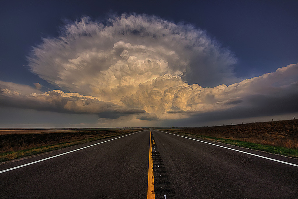
#5 Ethan Schisler (194 Likes)
Follow Ethan “Wyoming UFO” May 2014. Supercell spins over the amazing landscape of Northern Wyoming in May 2014. This put on quite the structure show….with a road leading perfectly right into the storm.
#6 Dillon Killoren (177 Likes)
Follow Dillon June 17, 2014Mullen, NE

#7 Dj Derve (155 Likes)
Follow Dj Well its edited to hell and back but I still like it! Alpena SD. 6-18-2014.
#8 Ryan Shepard (150 Likes)
Follow Ryan 10-1-14 Eureka, KS supercell at sunset.
#9 Gary Schmitt (138 Likes)
Follow Gary Another Chepota Ks. shot from 10.01.2014.
#10 Brandon VanDalsem (126 Likes)
Follow Brandon Turbulent skies dropping a lightning bolt over the Joplin Airport on 9/18/14.
Rising Stars
Images that did not qualify for the Top 10 but deserve a slice of the spotlight.
Crystal Emery Hooks
One of the most amazing evenings I’ve ever had at the beach! The clouds were breathtaking and the storms lingered just off shore. St. Petersburg, Florida 9-10-14.

Zach Young
June 20, 2011. Almena, KS. The funnel was nothing but dirt.

Paul Knightley
This tornado developed on an occluded mesocyclone somewhere south-west of Russell, Kansas, on May 25th, 2012. This scene is one I dreamed of many times in my younger days as the archetypal Great Plains tornado image - poles fading into the distance, with a tornado in shot.

Kevin Leclercq
Magnificent LP supercell in June 2014 in NE France near Troyes (10) of up to 9cm hailstones were identify in this supercell.

David Levy
This was a shot taken from last monsoon to pass through Chandler, AZ a few weeks ago (Sept 27, 2014) First time I’ve seen a low wall cloud and monsoon splitting out of the same front moving different directions.

Congrats Everyone!

Zach Roberts
Latest posts by Zach Roberts (see all)
- Top 10 Weather Photographs: 1/16/2015 - January 16, 2015
- Top 10 Weather Photographs: 1/15/2015 - January 15, 2015
- Top 10 Weather Photographs: 1/14/2015 - January 14, 2015
Related posts: